Chinatown

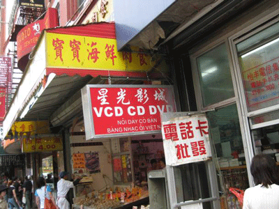
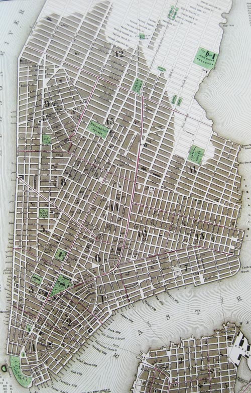
Many do not realize that New York's thriving Chinatown is a suprisingly recent phenomenon.  Even during America's open immigration years in the late 19th and early 20th centuries, Chinese were not welcome.  The Chinese Exclusion Act of 1882 formalized ugly prejudice.

New York's Chinatown stayed very small, surrounded in the early 20th century by Italian and Jewish immigrants.

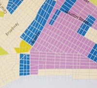
Even as late as 1950, Chinatown was small.

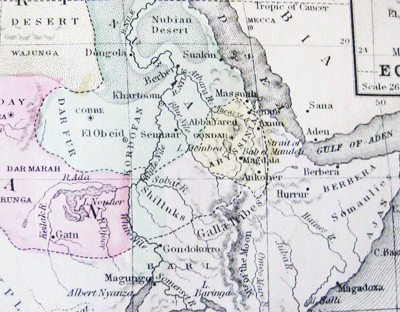
Chinese Exclusion stayed in effect de facto until 1965, when the racist provisions of US immigration law were removed, liberalizing immigration by all non-European groups.

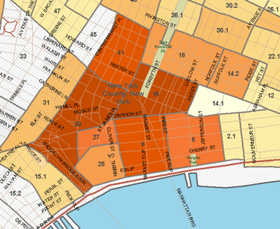
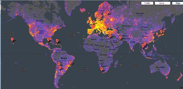
Only 5 years later in 1970, Chinatown had already expanded greatly. Italians and Jews had already left for middle-class and upper-class neighborhoods elsewhere

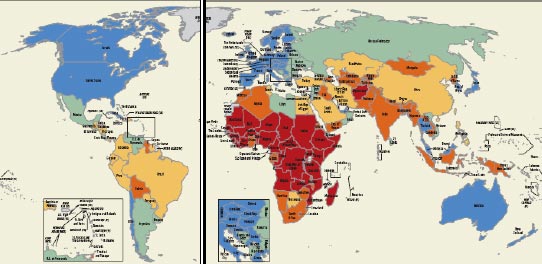
Today Chinatown is one of Manhattan's most thriving neighborhoods. Other East Asian immigrants also congregate there.

The ladder out of poverty continues for today's immigrants, following the Italians and Eastern Europeans, who in turn had followed the Germans and Irish.

The next time I have dim sum at Jing Fong on Elizabeth Street, I'll raise a glass of green tea to immigration freedom.

Credits: The Lower East Side in 1920 map is from Eric Homberger, The Historical Atlas of New York City, Henry Holt and Company, 2005, p. 136. The other maps are from the great software program and database, Social Explorer.
Chinatown in 2007

Read More & Discuss

The lure of starting from scratch

It is an acknowledged national characteristic that Americans believe in self-reinvention. One of our founding myths—inspired by the once unexplored and sparsely populated expanse of the North American continent—is the idea that you can head out of town, leave the encumbrances of the past behind, and start over in a new, unspoiled place. What would happen if we brought this sensibility to development plans for poorer, more crowded nations? What if we already do?

The ingredients for Paul Romer’s solution to global poverty include an unoccupied tract of land, a charter to lay out a new set of just and commerce-promoting rules, and two or more sovereign governments. Just as Hong Kong was created as an island of prosperity by the British in China (only voluntarily this time), poor countries would lease a piece of their land to a richer, benevolent government or group of governments that would agree to administer the new city according to the rules of the agreed-upon charter.

From a new article in Atlantic Monthly by Sebastian Mallaby, we learn that Madagascar might have become the first testing ground for Romer’s charter cities idea—if not for a coup that ousted the Malagasy President in March 2009.

Madagascar’s government was anxious to attract foreign investment, and it understood that a credibility deficit held it back…Faced with this obstacle, the Malagasy authorities were open to unconventional arrangements. To boost investment in agriculture, they were ready to lease a Connecticut-size tract of land to Daewoo, a South Korean corporation, for 99 years…Romer’s proposal fit in with these adventurous ideas.…

Romer made his pitch for a charter city, and Ravalomanana responded that he wasn’t sure one was enough; if Romer could identify two rich countries willing to play the role of government trustee, it might be better to launch two parallel experiments. The president and the professor agreed that the new hubs should be open to migrants from nearby countries as well as to locals. They rose to examine a map of Madagascar on the study wall. Ravalomanana suggested building the first city on the island’s southwestern coast, which was largely uninhabited because of its dry heat. To Romer, the site sounded very much like the coastal locations that appeal most to the world’s affluent as vacation spots.

Ravalomanana’s government was toppled before any of these plans could go forward, in part as a result of violent protests over the perceived threat to national sovereignty represented by the Daewoo deal. As Mallaby points out, this failures suggests at least one flaw of the charter cities idea—that land ownership and sovereignty are explosive issues that may not be easily or peacefully negotiated away by leaders on behalf of their people. But Romer remains optimistic, and is talking to other African leaders, possibly ones with more staying power.

The charter cities idea appeals because it is bold. It promises a fresh start for people mired in the muck of old conflicts, inequality, and bad government. When Mallaby concludes “When African teenagers do their homework under streetlights, isn’t Romer right to think the unthinkable?,”  he is arguing that while there may be legitimate concerns about the ethics or feasibility of the charter cities, those concerns are made irrelevant by the overwhelming gravity and scale of global poverty and inequality.

In other words, big, desperate problems call out for big, radical solutions. Solutions that sweep away the detritus of past failure, promise to replace it wholesale with something new and better, and perhaps even alter the boundaries of the world as we know it.

The discussion about rebuilding Haiti has been full of ideas about the earthquake as an opportunity to ”start over,” “reboot,” “wipe the slate clean” and finally “get things right” (some stellar examples here). Two recent proposals brought the call for slate-cleaning back to Africa: We already blogged Professor Pierre Englebert’s suggestion in the NYT for the international community to “move swiftly to derecognize the worst-performing African states” like Chad, the DRC, Equatorial Guinea and Sudan, and in Foreign Policy, G. Pascal Zachary submitted that “no initiative would do more for happiness, stability, and economic growth in Africa today than an energetic and enlightened redrawing” of Africa’s colonial borders.

Call it the “let’s just scrap this mess and start over” approach to development.

Unfortunately, in earthquake-devastated Haiti as in troubled central Africa, the promise of starting from scratch is an illusion. It has always been true that no matter where you go, you take yourself with you—culture, history, habits, attachments and animosities come along like a skin you can’t shed. But these days there are fewer and fewer territories on our taxed and shrinking planet beyond the reach of someone’s determined claim.

These ideas share an overly-optimistic belief in a neutral, benevolent international community and its power to peacefully oversee imposed changes. All are tone-deaf to the very real degree of nationalism that does exist in basically all countries by now, regardless of whether they were misbegotten colonial creations or not. They also violate sovereignty as conventionally defined, which may be good or bad but is sure to provoke a nationalist reaction.

Early development economists working at the hopeful dawn of colonial independence believed that they really were starting from scratch. The last fifty years have shown us that they weren’t, and this has been—and remains—one of development’s biggest blind spots.

Read More & Discuss

Big places have small beginnings: increasing returns in Greenwich Village

Bought this great book of New York City historical maps today.

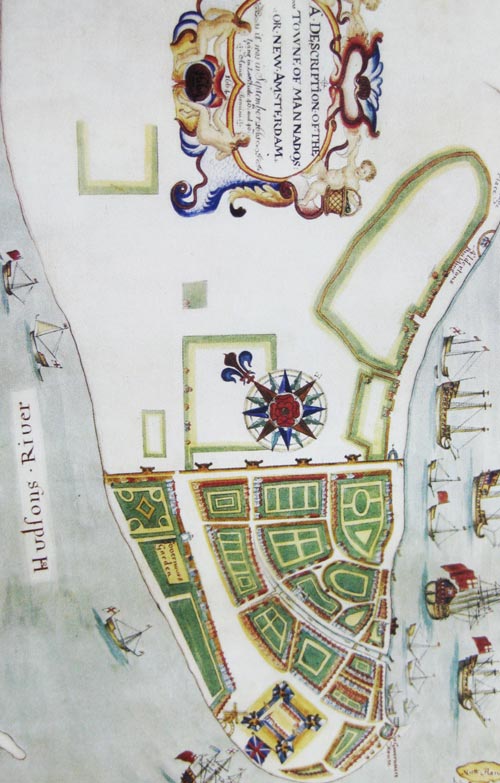
This is a map of "Mannados"  in 1664. The northern edge of New Amsterdam (just in the process of changing its name to New York) was protected by a wall, and hence the street along the wall was called "Wall Street."

The next map is from 1766.  The city has spread a bit north now, but still has a long ways to go. Population had only recently passed 10,000. The port was way behind Boston and Philadelphia and barely ahead of Newport, Rhode Island.

 Way up in the upper right on the Hudson is a little hamlet called Greenwich, surrounded by lots of farmland.  Directly east of this hamlet, which was roughly around where Hudson and Christopher Streets intersect today,  is where I am typing these words right now.

The last map is from 1836, when the city has spread as far as around 14th street. In the summer of 1822, there was a yellow fever epidemic in New York, reflecting the poor sanitation in the city among other things.  This was the last straw for the wealthier inhabitants who moved to a suburb that became known as Greenwich Village, named after the hamlet in the previous map.  To maintain property values in the Village, an enterprising New York mayor named Philip Hone created a Washington Memorial Parade Ground (the land was available because it was a graveyard for the criminals and poor; Mayor Hone just paved over it; many remains are still buried beneath what is today's Washington Square).

In the map, directly beneath the number 15 is a little building on the west of Washington Square that housed the entirety of New York University in 1836.

Why did New York (and Greenwich Village) thrive so much more than other east coast cities? Cities are obvious cases of increasing returns, where the more you have already, the more new stuff you attract.  (Many people have looked for development insights from this, without ever really resolving what they are.)

Another important event between map 2 and map 3 was the opening of the Erie Canal on October 26, 1825.

New York had major geographic luck -- the lowest point to cross the Appalachian Mountains was just west of Albany,  so the Erie Canal could connect the vast interior linked to the Great Lakes to Albany and down to New York City. After the Erie Canal became defunct, New York had now had such a head start that it is still the premier East Coast  city. (Historical neighborhood details from here.)

As Billie Holiday sang, "them's that's got shall have, them's that's not shall lose."

Read More & Discuss

Sorry, Africans, you are no longer allowed to have your own countries

An imaginative proposal in a column by Pierre Englebert in today's NYT:

the international community must move swiftly to derecognize the worst-performing African states.

The problem of Africa that Professor Englebert is nicely fixing was that 50 years ago:

these countries were recognized by the international community before they even really existed.

So because the Western powers (affectionately called here "the international community") supported with abundant aid dollars the tyrants who oppressed their own citizens, those same citizens are going to be further punished by those same Western powers who will turn them into stateless persons without a country.

Characteristically for most grand schemes to "fix Africa" from outside, the column does not consider how this proposal might affect individual Africans; it only offers highly speculative hopes for how erasing countries from the map might make the rulers behave better after they no longer have a state to rule.

I have a couple of random thoughts on this for Professor Englebert:

(1) shouldn't you have considered an intermediate step of stripping the tyrants of just the aid dollars, while allowing the citizens to keep their own countries?

(2) do you really think the World Cup was the best time to propose such a scheme? I myself had not noticed the phenomenon of Africans not caring about the football teams of their non-existent nations.

Read More & Discuss

Little Ghana: Where each World Cup team's fans are in New York City

The Wall Street Journal has a great map feature today in its New York section showing where each World Cup country's nationals live in New York City. The map to the left shows the Ghanaians in New York in green.  Morris Heights in The Bronx seems to lay the strongest claim to a Little Ghana, although there are also outposts in the Lower East Side, Brooklyn, and Staten Island. The soccer balls show where there are bars or restaurants showing the World Cup -- looks like not manysuch  bars available in Little Ghana.

The map below shows where a big Cup favorite's fans live: Brazil (in yellow).  Apparently there are both wealthy Brazilians on the Upper East Side and Upper West Side, and poorer ones in Harlem and Queens.  Maybe class differences are one reason Brazilian New Yorkers complain about the lack of any community spirit among themselves.

Of course, Aid Watch must draw at least 3 major development insights from all this, which is that

(1) nationals are remarkably concentrated, which may be both a strength (helping new immigrants adapt) and a weakness (persistent segregation prevents economic assimilation) not to mention blah, blah, and blah,

(2) too bad the soccer bars are so unequally distributed, moreover blah, blah, and blah,  and

(3) forget all that and enjoy the World Cup, the event that unites all development folks, even soccer-challenged Americans.

Read More & Discuss

Touristiness

This map of how popular different tourist places are was generated by an Estonian programmer using the number of photo uploads to a popular site. Yellow is the most touristy, followed by red, blue is not very touristy, but grey is nowheresville.

I am a little suspicious about the methodology after I saw Toledo, Ohio show up pretty yellow. However, otherwise the map seems plausible. Coasts and mountains show up about as much as you would expect, the BosWash and LosAngeSanEattle regions are hot, and nothing beats European Ye Olde Towne Squares. In the developing world, tourist spots are as expected, including the unjust and sad omission of Africa.

The next image shows a blow up of Africa.  The no-go regions are mostly the obvious ones (better book that vacation to Chad before it's spoiled!), as are the Safaris and Coasts in Kenya, Tanzania, and South Africa. Lesser known tourist success stories in Namibia and Ethiopia also show up.

I'm a little more mystified by a blow-up of West Africa. I know vaguely about the tourist success in Gambia and to a lesser extent, along the coast of Ghana. The hot spots in Bissau, Conakry, Freetown, Monrovia, Niamey, Bamako, Abidjan, Ouagadougou, and Abuja are a little more surprising -- perhaps camera trigger-happy aid workers?

Read More & Discuss

The map history of an unhappy place, 1829-present

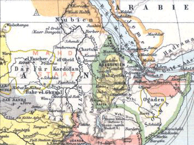
In the greater Horn of Africa, the talk is of civil war, genocide, tyranny, interstate war, failed states, fragile peace. Where did this all come from? One perspective is given from Europeans' maps of this area. The maps below are cropped so as to cover the exact same area from the Tropic of Cancer to the Equator, from 20 degrees longitude to the tip of the horn (approx. 50 degrees longitude). The maps are from early 1800s (exact data unknown), 1829, 1885, 1906, 1924, and the Present. The place names appear early on: Darfur, Somalia, (or earlier versions of those names, like Nubia for Sudan, Abyssinia for Ethiopia), but the borders are remarkably unstable.

Among the forces at work changing the map are Europeans’ increasing knowledge of the area, the expansion of European colonial control, European border changes, and Ethiopian expansion. Somehow it led to the present mix of tragic mess, cultural richness, and potential for hope.

Read More & Discuss

Michael Clemens won’t let up on the Millennium Villages + bonus links

It’s nice to see scholars bringing attention to the critical need for evaluation and informed public dialogue (not just “success stories” or short-term impact evaluation) for the Millennium Villages Project, which we have also covered on this blog. Michael Clemens of the Center for Global Development is currently carrying on a very revealing dialogue with Millennium Villages. In Michael’s first blog post which we blogged, he makes three central points:

  1. The hundreds of thousands of people living in the Millennium Villages, present and future, deserve to know whether the project’s combination of interventions is backed up by good science.
  2. Randomized evaluation is the best way to do this. While it may be too late to properly evaluate the first wave of villages, there is still time to conduct such a study for the next wave of villages.
  3. The MVP evaluation should demonstrate long-term impact before it is scaled up.

In a subsequent post, Michael parses the curious non-answer he receives from the director of monitoring and evaluation for the MVP, Dr. Paul Pronyk. He breaks down—for those of us not intimately involved in the finer details of impact evaluation—the difference between true scientific evaluation and what the MVP says it is doing, namely “matched randomly selected comparison villages.”

What the MVP has done is something very different from…a rigorous evaluation.  First, village cluster A1 was chosen for treatment, for a range of reasons that may include its potential for responding positively to the project.  Then, long after treatment began, three other clusters that appear similar to A1 were identified — call these “candidate” comparison clusters A2, A3, and A4.  The fact that all three candidates were chosen after treatment in A1 began creates an enormous incentive to pick those candidates, consciously or unconsciously, whose performance will make the intervention in A1 look good.  Then the comparison village was chosen at random from among A2, A3, and A4.

Differences between the treated cluster and the comparison cluster might be due to the MVP. But those differences might also be due to how the original Millennium Village was chosen, and how the three candidate comparison villages were chosen.  This is not a hypothetical concern…

So, either the MVP director of evaluation does not understand evaluation...or he thinks we won't know the difference.

Dr. Pronyk promises the release of the MVP’s midpoint evaluation at some unspecified time later this year, and said they “look forward to an active discussion about the initial findings regarding poverty, hunger, and disease in the Millennium Villages.” We hope the scholarly community and the wider reading public concerned with development issues will give Dr. Pronyk precisely what he’s asking for.

Bonus Links

* Sounds a bit like a parody we wish we’d written….but it’s true. Yesterday’s NYT features this quote from a story on China’s bid to supply California with technology, equipment and engineers to build a high-speed railway, and to help finance its construction:

“We are the most advanced in many fields, and we are willing to share with the United States,” Zheng Jian, the chief planner and director of high-speed rail at China’s railway ministry, said.

* We’d be remiss not to mention this helpful timeline of celebrity aid to Africa featuring an interactive map from Mother Jones (and some additional commentary from Wronging Rights and Texas in Africa.)

Read More & Discuss

You want cell phone entrepreneurs, we’ll give you cell phone entrepreneurs

Last week we posted some cool maps showing the spread of cell phones especially in Africa over the last decade. We called this “a triumph of bottom-up entrepreneurial success,” but you weren’t convinced. You thought it was foreign direct investment (FDI). Provide more evidence that entrepreneurs are part of this picture, you said. Aid Watch never declines a challenge: 1) OK, it’s true that 52 percent of the African Market is dominated by 6 multinationals: Orange (France), Vodafone/Vodacom (UK/South Africa), Zain (Kuwait), MTN (South Africa), Moov (UAE), and Tigo (Luxembourg).  But that other 48 percent is the battleground of dozens more, many of them home-grown.  (Also we heard a rumor that South Africa is located somewhere in Africa.) To give an example from The White Man’s Burden:

Entrepreneur Alieu Conteh started building a cellular network in the Democratic Republic of the Congo … when it was still in the midst of its civil war in the 1990s. He couldn’t get foreign manufacturers to ship cellular towers into the country with rebel soldiers around, so he got local men to weld scrap metal into a makeshift tower. Demand exploded for Conteh’s phones, and in 2001 he formed a joint venture with the South African firm Vodacom. One illiterate fisherwoman who lives in the Congo without electricity relies on her cell phone to sell her fish. She can’t put the fish in a freezer, so she keeps them alive on a line in the river until customers call to place an order.

Sudanese-born entrepreneur Mo Ibrahim is another example. His mobile telecom company, Celtel, had about 5 million subscribers in 13 African countries when it was sold in 2004 for $3.4 billion. 100 Celtel employees, most of them African, earned more than $1 million from the sale. Celtel is now part of Kuwaiti-owned Zain, which serves 40 million subscribers in 17 African countries.

2) Being a successful mobile operator often requires big infrastructure investments, so it’s no surprise many of the first telecom firms to enter the African mobile market have been large. Multinationals investing in Africa to provide millions of Africans with essential service is a GOOD thing. Yes, the market needs more  effective regulation, increased competition, and lower end-user costs, but those trends are now happening.

3) Multinationals spur smaller entrepreneurs. The Nigerian telecom sector has created some 450,000 indirect jobs since it was liberalized in 2000. And Uganda’s five mobile operators provide employment for more than 100,000 people, who work for the operators directly or indirectly, selling airtime or handsets. An Economist article noted:

In 2003 Ms [Mary] Wokhwale was one of the first 15 women in Uganda to become “village phone” operators. Thanks to a microfinance loan, she was able to buy a basic handset and a roof-mounted antenna to ensure a reliable signal. She went into business selling phone calls to other villagers, making a small profit on each call. This enabled her to pay back her loan and buy a second phone. The income from selling phone calls subsequently enabled her to set up a business selling beer, open a music and video shop and help members of her family pay their children’s school fees.

4) Finally, farmers and fishermen now check prices in markets across the country before selling their goods, while unbanked buyers can make payments with mobile banking technologies. Individual entrepreneurs are beneficiaries of mobile technology’s spread in a big way.

Read More & Discuss

Miracles of spontaneous order: where to get a cab around NYU

The New York Times has this wonderful interactive feature today, where you can see where most cab pickups and dropoffs happen at any time of day on any day. It confirms a puzzling feature that I had already observed: getting a cab is hopeless at one corner, but if you move just one block over you are sure to get one. The map shows the number of cab pickups around NYU at 5pm on a Friday, the legendary time when it is most difficult to get a cab. Most of the immediate NYU area (around Elmer Holmes Bobst Library)  is a taxi desert, so you have to walk either west to Sixth Avenue (a well known hot spot along most of its length downtown), or east to Lafayette (for example, Astor Place).  One thing that has always puzzled me is that it's always very hard to get a cab on Broadway, running parallel to Lafayette  just one block west.

Here's one amateur theory: the less obvious hot spots (excluding train stations etc.) can emerge out of nothing.  Over time taxi customers expect to get a cab on one street corner. Then taxis are more likely to cruise that street corner because that's where the customers are.  Both customers and taxis keep going to that street corner more and more as both sides come to expect the other to behave that way. And bang, you have now gotten the 1,425,674th example of spontaneous order.

This is a good metaphor for development because....

Read More & Discuss

Who ya gonna call? Entrepreneurs!

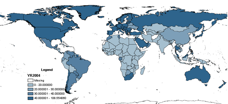
Just a decade ago it seemed we were stuck with landlines. State-owned telephone companies were largely entrenched, sclerotic organizations that provided poor, delayed, or simply unavailable service —even in some rich European countries, and nearly universally in poor countries. These maps (with data from 2001, 2004, and 2008) show how cell phones have quickly bypassed the dysfunctional landline companies and emerged as a triumph of bottom-up entrepreneurial success.

The measure is cell phone subscribers per 100 population, with darker shades of blue indicating movement from 0-20 to 20-30 to 30-40 to above 40 (above 40 is the dark blue shade that is most evident in all the graphs).

Note the darker blue color now encroaching on all sides of the African continent. This gives us hope that the dynamism of the bottom from entrepreneurs can overcome sclerosis at the top.

2001:

2004:

2008:

Data source: World Development Indicators

Read More & Discuss

Is it OK to make ethnic slurs about some groups of white people?

For tonight's NCAA basketball showdown between U of Kentucky and West Virginia U, I bet the Kentuckians Dennis Whittle and April Harding some West Virginia maple syrup against Dennis' bet of a country ham and April's bet of a Derby pie. Of course, some of  you are thinking why didn't you bet {insert insulting Appalachian stereotype here}?

Both Kentucky and West Virginia suffer from frequent ethnic jokes involving some combination of:

  • incest
  • feuds
  • moonshine
  • reference to movie Deliverance (which actually takes place in Georgia)

Which makes me wonder, why is still OK to make ethnic slurs against some groups of people as long as they are white? Perhaps it reflects this furious pent up demand by white people for  ethnic slurs, cruelly thwarted by the civil rights movement (also known as "political correctness" if you  were not a big fan of the civil rights movement).  I've had people tell me insulting jokes about West Virginians even AFTER they know I was born in West Virginia.

Of course,  ethnic slurs are pretty universal around the world. Latin American soccer games are famous for having fans taunt the visiting team with ethnic slurs.

Read More & Discuss

When Kenya saved Washington DC

In today's NYT :

... everyone-as-informant mapping is shaking up the world, bringing the Wikipedia revolution to the work of humanitarians and soldiers who parachute into places with little good information. And an important force behind this upheaval is a small Kenyan-born organization called Ushahidi, which has become a hero of the Haitian and Chilean earthquakes and which may have something larger to tell us about the future of humanitarianism, innovation...

{It helped} in Washington, D.C., where The Washington Post partnered to build a site to map road blockages and the location of available snowplows and blowers.Think about that. The capital of the sole superpower is deluged with snow, and to whom does its local newspaper turn to help dig out? Kenya.

Read More & Discuss

Links for Chile earthquake

@chrissiy: links for Chile mapping response including Google tools, @Ushahidi http://bit.ly/b80EvW @saundra_s Latest Post: Chile may not need or want foreign assistance http://bit.ly/cLct9C

@AidNews Chile earthquake: Emergency funds released http://dlvr.it/3mL5

@AidNews PHOTOS: Massive quake hits Chile http://dlvr.it/3lwR

@dfid_uk #Chile #earthquake : A #DFID assessment team is on standby. We remain ready to provide humanitarian support if needed http://ow.ly/1c7qB

@dfid_uk RT @foreignoffice: British Ambassador to #Chile describes 'impressive' rescue effort after earthquake yesterday http://ow.ly/1c8Ho

GlobalGiving @GlobalGiving New Project! GlobalGiving Relief Fund for Earthquake in Chile http://ow.ly/16GltH

@Oxfam Oxfam sends staff to respond to #Chile #Earthquake http://bit.ly/cTvAYn #terremotochile

Oxfam International @Oxfam Oxfam emergency response team due in Santiago, Chile this pm (Mon) 3pm local time http://www.bit.ly/cTvAYn #earthquake

@sociolingo RT @caribnews: Amazing photo essay of the earthquake in #Chile. (high quality images from AP/Getty/AFP) http://bit.ly/aNv8RV

@carlosmontes1 @bill_easterly but please let's not use this natural disaster as yet another intellectual opportunity to make points about aid

@carlosmontes1 good point, can you explain more what would bother you?

carlos montes carlosmontes1 @bill_easterly thanks! it would b sad (but human) 4 "aid experts" 2 become disaster paparazzis, now is time 4 ushahidi etc not grand theories

@ithorpehttp://is.gd/9s3Ih"UNICEF and partners stand ready to help after massive earthquake strikes Chile"

@ithorpe: Relief web updates on Chile http://is.gd/9s5HK (incl. OCHA sitreps)

Read More & Discuss

Take seriously the power of networks (or just look at some COOL maps)

A few days ago, I met a guy because he was my wife’s girlfriend’s boyfriend. He turned out to be a high ranking official who had some fascinating inside stories about aid and corruption in an African country (which I won’t name to protect his privacy). A local aid worker friend recommended an orthopedist to treat my wife’s badly injured ankle while we were in Addis Ababa. The orthopedist was able to give my wife relief (at full American prices, which went to his NGO) and then he asked if I knew that crazy aid criticizing NYU professor.

One of the best hiring decisions I ever made was to employ my friend’s wife’s neighbor’s daughter.

More and more people are discovering the power of social networks (consult the avalanche of popular books on connectedness and shrinking degrees of separation). Being well-connected to other people, who are in turn well-connected, is a powerful way to get information, to reduce search costs for employment or trade transactions, and to create strong incentives to behave well and protect your own reputation. Formal research in economics celebrates the economic payoff to social connectedness (aka social capital). Phenomena like the Hasidic diamond merchants of 47th street in Manhattan show the power of business networks based on ethnicity and family. Ethnic networks are common in Africa, like the Hausa traders in West Africa, or Luo fish merchants in Kenya.

The scorn usually shown for Nepotism and the Old Boy Network is so 20th century! The 21st century view is to respect the value of social connections wherever they come from!

OK, I’m exaggerating. You need to balance the value of social connections against accountability mechanisms, merit-valuing incentives, and ethical rules, so I don’t just hire my good-for-nothing cousin with other people’s money. Also you need to worry about people who are frozen out of networks through no fault of their own. But that is OFF MESSAGE, so I am going to ignore all that today.

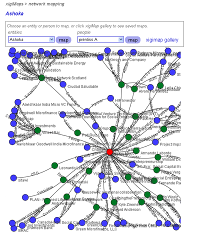
Venture capitalists rely heavily on social networks to assess reputation and to make new deals. And so do social entrepreneurs. Someone tipped me off to xigi.net, which is a fantastic web site for facilitating networks among social entrepreneurs:

xigi.net (pronounced 'ziggy' as in zeitgeist) is a space for making connections and gathering intelligence within the capital market that invests in good. It’s a social network, tool provider, and online platform for tracking the nature and amount of investment activity in this emerging market.

OK, I confess, what really got me to look at this site was the hyper-cool network maps that show connections between the social entrepreneurs. Check out the map for the deservedly well-connected Ashoka folks of Bill Drayton (this is a screen shot, but you have to visit the map on the xigi site to explore its cool functionality).

The point is that part of the effectiveness of Ashoka is because they are so well connected, and they make all their partners in turn more effective in turn by being connected to the well-connected Ashoka.

We could keep dreaming: social networks could be a powerful vehicle for spreading information and evaluations about existing aid projects and actors. The Internet makes this much more feasible that it used to be. GlobalGiving.org is one initiative that tries to implement this idea. Oh, and I happen to know about and trust GlobalGiving because I have known the two founders ever since we worked together on Russia in the early 90s.

I had never heard of xigi.net until a couple days ago. I heard about it from my wife’s girlfriend, the one who had the aid and corruption story-telling boyfriend.

Read More & Discuss

Haiti earthquake: Help navigating complex terrain of disaster relief

Today our thoughts go out to those who are suffering from the devastating earthquake that hit Haiti yesterday, and to all those contributing to relief efforts there. An email we received this morning from Saundra Schimmelpfennig, who has experience coordinating tsunami relief in Thailand and writes the blog Good Intentions Are Not Enough, highlights some of the problems that arise in responding to a large scale disaster such as this one:

Immediately after a disaster is prime fundraising time for NGOs. So they all rush in and put out immediate appeals before there's any clear idea of what or how much they can actually help. Only fund those that already have an office established in country because of the amount of time and money it takes to get anything more than just search and rescue up and running. If you want to move into anything such as temporary shelters, food distribution, those with an already established presence will know the people and systems better and be able to work more quickly and less expensively.

I prefer for people to try to support small, local CBOs [Community-based organizations] as they are already on the ground responding, and will be helping in the country for a long time.

Ideas for how to help and where to give:

Getting and sharing information:

First-person accounts and in-depth coverage:

Humanitarian response:

Read More & Discuss

How to write about poor people

  1. world-bank-poverty-numberUse a precise definition of poverty: living on less than $1.25 a day, adjusted for purchasing power. Give the precise number who fit that definition.
  2. Ignore the recent revision of  this number by 42%.
  3. Do not excessively analyze geographic or ethnographic distinctions amongst poor people.blank-world-map
  4. Discuss the following: poverty traps, vicious circles, aid financing gaps.
  5. There probably won't be time left to discuss the following concepts: initiative, savings, inventiveness, resourcefulness, adaptation to local conditions, or local knowledge.
  6. Discuss only income, health, access to clean water, and literacy. Leave it to anthropologists to cover areas like happiness, traditions, ceremonies, festivals, friendships, kinship, love between men and women, or love between parents and children.
  7. ug2_palenga_2boys_05Display pictures of poor children (alternatively women).
  8. Don't show pictures of poor men, who make your audience think of drunkards, wife-beaters, or janjaweed.
  9. These topics are only for Marxists: power, class, discrimination, oppression, or history.
  10. Your knowledge about poor people should come from other writers who observe these rules.
Read More & Discuss